ArcGIS
ArcGIS is a well-known and widely used geographic information system developed by the American company Esri. It offers a wide range of functions and covers a large number of application areas and software components (desktop GIS, web GIS, cloud GIS, mobile GIS, etc.) like almost no other GIS software.
Desktop GIS
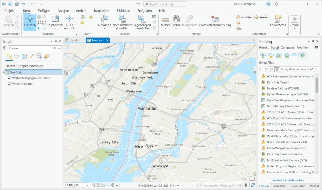
Esri started in 1982 with ARC/INFO, a command line based GIS program. In 1999, ArcMap was released, a desktop GIS with a graphical user interface. Finally, in 2015, ArcGIS Pro was released, a new comprehensive GIS program based on more modern technologies that supports 2D and 3D maps.
ArcGIS Pro
ArcGIS Pro is Esri’s flagship GIS program. Whether you want to work with 2D or 3D maps, analyze or edit data, publish services or provide data in ArcGIS Online, work with one of the many geoprocessing tools or use one of the many other applications of the software, you will be amazed by the potential of ArcGIS Pro.
ArcGIS Pro offers various options for programmatic extension and the creation of your own geoprocessing tools. This means that there are virtually no limits to the possible uses of the software.

ArcGIS Desktop
ArcGIS Desktop with the ArcMap and ArcCatalog applications were the standard GIS applications at Esri for a long time, with which all common GIS tasks could be completed. The applications are based on an extensive library of GIS components called ArcObjects, created using Microsoft COM technology. In the meantime, ArcGIS Pro, a new desktop GIS application created with more modern technologies, has been developed to replace the previous ArcGIS Desktop.
The current version of ArcGIS Desktop is ArcGIS 10.8.2. This is the last version of ArcGIS Desktop and will only be supported until March 1, 2026. Users of the software should upgrade to ArcGIS Pro in good time.
ArcGIS Enterprise
ArcGIS Enterprise is a server-based GIS software that provides map services and other GIS services for use on the web. With ArcGIS Enterprise you can set up a complete web GIS in your own company infrastructure. Portal for ArcGIS, which is part of ArcGIS Enterprise, can be used to control access to the various contents and release them for specific user groups.
ArcGIS Online
ArcGIS Online is a SaaS GIS platform from Esri that allows you to provide geodata in the cloud without your own server infrastructure. With ArcGIS Online, you can create your own web maps and use them in web applications that are created with ArcGIS Experience Builder or the ArcGIS Maps SDK for JavaScript, for example. Or you can create dashboards that use the geodata from ArGIS Online or access it with mobile apps such as ArcGIS Field Maps or Servey123.
Mobile GIS
With various apps for mobile devices, such as ArcGIS Field Maps and Servey123, field workers can collect data both when they are online and when they are offline in remote areas, and later synchronize the data with the central database.
To develop your own specialized mobile apps, you can use one of the SDKs provided by Esri, such as the ArcGIS Maps SDK for Kotlin (for Android) and the ArcGIS Maps SDK for Swift (for iOS).